Convincing results
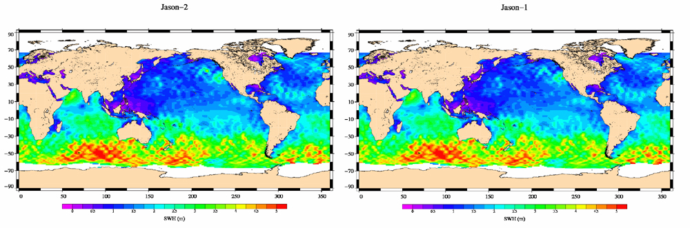
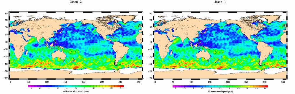
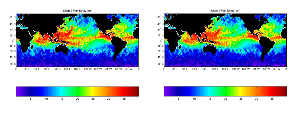
It has taken Jason-2 less than one month to deliver its first maps of global ocean surface topography, surface wave height and wind speed. “We’re delighted with what we’re seeing!” says Nicolas Picot, Jason-2 Product Quality Manager at CNES. “With all the hard work that everyone has put in, we were hoping initial results would compare well with Jason-1 but we weren’t expecting them to be this good so soon! Jason-2 is performing really well.”
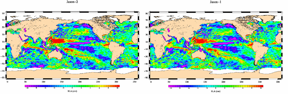
On 4 July, 2 weeks after launch, Jason-2 reached its final operational orbit of 1,336 km. It is now flying in formation with its predecessor Jason-1, trailing it by 55 sec. in the same orbit. The 2 satellites are making nearly simultaneous measurements that are allowing scientists to precisely calibrate the new satellite's instruments. “They will be flying in formation until at least early November,” says Nicolas says Nicolas Picot. “Once the 4 mission partners* give the all-clear, Jason-1 will move into a parallel ground track midway between two Jason-2 ground tracks, thus doubling the amount of data collected.”
A wealth of potential applications
Jason-2 measures ocean surface topography, that is, the height of the theoretical ocean surface relative to the Earth’s centre. Interpretation of ocean surface topography data yields information about current speed, sea level, ocean temperature and salinity.
Jason-2’s main objective is to extend the continuous record of oceanography data begun in 1992 by Topex/Poseidon and continued by Jason-1 since 2001. Such data give precious indications for monitoring rising sea level and climate change.
Jason-2’s main objective is to extend the continuous record of oceanography data begun in 1992 by Topex/Poseidon and continued by Jason-1 since 2001. Such data give precious indications for monitoring rising sea level and climate change.
* Jason-2 is a joint endeavour between CNES, NASA and 2 operational data distribution agencies, NOAA in the United States and Eumetsat in Europe.
* Jason-2 is a joint endeavour between CNES, NASA and 2 operational data distribution agencies, NOAA in the United States and Eumetsat in Europe.
More about
JASON, the ocean observatory
TOPEX/POSEIDON, the beginnings of satellite oceanography
How altimetry works
TOPEX/POSEIDON, the beginnings of satellite oceanography
How altimetry works
Related links
Côte d'Azur's observatory website
T2L2 on CNES Website
Aviso/Altimetry website
NASA website
NOAA website
EUMETSAT website
CLS website
T2L2 on CNES Website
Aviso/Altimetry website
NASA website
NOAA website
EUMETSAT website
CLS website